Harvest Manager
Managing your harvest plans from start to finish.
Atlas Harvest Manager provides the forest manager with tools to manage harvest areas within the forest estate.
The Harvest Manager can record planned harvest areas years out into the future, track changes as the areas are prepared for production, and finally monitor progress as the harvest is carried out. ATLAS Harvest Manager is not an engineering tool for calculating the optimal design for harvest areas – other tools do this, but rather it is a management tool that enables managers to keep an overview of all harvest areas within their estate using a centralised system.
| Benefits | Features |
|---|---|
| Overview of all harvest areas | Harvest Manager maintains its information in a centralised system so that all users within the company can view the state of any harvest area. |
| Stand Details readily available | Harvest Manager is tightly integrated with GeoMaster, which can provide information about any stands falling within harvest areas. |
| Managing settings, crews, and schedules | A harvest area comprises a collection of settings, each of which can have a schedule and crew assigned to it. |
| Preparation of harvest areas | Harvest areas can be planned years in advance and easily reconfigured as the plan progresses. |
| Monitoring changes of state | Harvest Manager can easily report on changes in status, area, and crew over time. |
| Reporting yields | Yield data can be supplied from a wide range of sources, and aggregated to various levels – e.g., from stands to settings and harvest areas. |
| Mapping capability | Planning and standard operational maps can readily be generated and printed or saved to a file. |
| Information independent of GIS | All attribute information that doesn’t require a map can be accessed by any user |
Each Harvest Area Is Made Up Of A Collection Of Settings That Will Be Harvested Within One Plan.
Each setting typically represents a contiguous area of forest that will be harvested in one operation, using one harvesting method (ground-based, hauler, ect).
As the harvest area is prepared for logging, each setting is allocated a schedule and assigned a crew. Setting yields can be derived from contributing stands or recorded directly for the setting. Setting yields are also aggregated so that the total yield for the harvest area can be reported. There is no requirement for harvest area boundaries to align with stand boundaries, and the areas of stands that fall within harvest areas are automatically recalculated in ATLAS GeoMaster whenever a harvest area is edited in the GIS (ArcGIS).
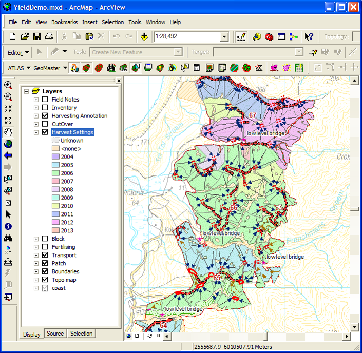
Tools for harvest planning are integrated into the GIS, making it easy to create harvest plans and configure them during the planning process.
Crop details such as species and age distribution within the harvest area are automatically available from GeoMaster, along with expected product yields.
Harvest Manager has query and reporting tools to enable planners to select harvest areas that meet given criteria and report on their properties or have properties presented as thematic maps. Since all attribute information is maintained in a centralised SQL database (within GeoMaster) it is accessible to all authorised users within the organisation, whether they have GIS available or not. Standard operational maps of harvest plans can be generated through ATLAS GeoMapper, which has access to both GIS and GeoMaster data.
Harvest areas normally advance through a series of states; the common ones being ready, started, completed, signed off, and inactive, although these are fully configurable. Status changes can be traced, as can changes in crew and area. As the harvesting progresses, the cutover can be mapped, and estimates of cut and remaining yields can be reported. Actual yields can be recorded alongside estimated yields to provide a starting point for yield reconciliation using, for example, ATLAS Yield Table Manager.
Integration with the ATLAS Suite of Products.
Integration between ATLAS modules enables information from one application to be accessed or presented within another, which greatly increases the power of each module and the suite as a whole.
For example, GeoMaster can provide stand details for Harvest Manager, including yields that may have been supplied by Cruiser or Yield Table Manager; Document Manager provides easy access to all documents relating to the harvesting operation, and GeoMapper can be used to create all the necessary maps.