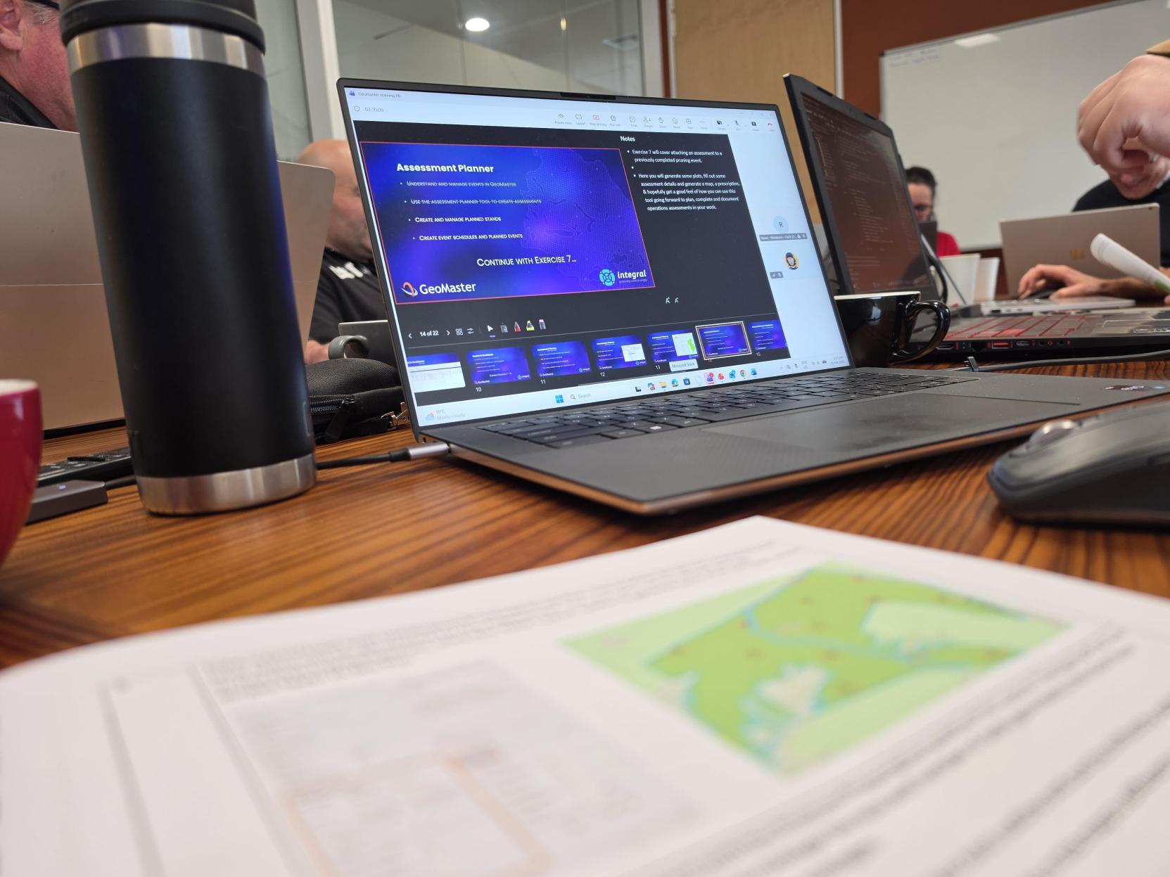
GeoMaster
All information about the forest estate is at your fingertips…
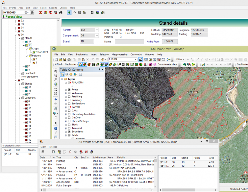
Atlas GeoMaster enables the forest manager to easily manage information about their estate.
It is primarily an operational tool used to plan, manage, and Report on all activities within a forest.
GeoMaster maintains a history of all events and changes in area and structure over time and all rotations, allowing tracked changes in stocked and total area.
Through its seamless integration with GIS, GeoMaster enables users to perform their tasks using maps (on-screen) to record areas and activities accurately. On the other hand, for users who prefer to avoid the cost and complexity of GIS, the full non-spatial functionality
| Benefits | Features |
|---|---|
| Centralised Access to Data | As a central repository, GeoMaster provides ready access via queries, reports, and maps to all forestry-related information for all users in the organisation. |
| Financial Tracking | Unique job numbers enable operations in GeoMaster to be linked to finance systems and enable cost-tracking |
| Business Planning | GeoMaster enables operations to be planned well into the future so they can be budgeted and prepared for |
| Environmental Management | GeoMaster isn’t just about production forestry; it can manage the whole estate |
| Spatial Interface | All the powerful capabilities of the GIS can be exploited on the manager’s desktop while maintaining full integrity with the forest management system |
| GIS Independence | Users who do not require a spatial interface can operate GeoMaster independently of GIS and have full update, query, and reporting access |
| History on-line | It is possible to view (and edit) the structure of the forest estate at any point in time, including previous rotations. This reduces dependence on the institutional knowledge of key individuals |
| Flexibility | There is plenty of scope for users to define specific events, assessment attributes, and other properties. Customised behaviour can also be provided for clients |
| Secure Database | GeoMaster can be configured so that the data cannot be directly accessed/updated by other applications (e.g., Microsoft® Access) |
| Database Access | While blocking direct access to the database, GeoMaster can still allow other applications (e.g., Excel) to view, extract, and update data via its COM interface |
| Future Proof | Based on traditional SQL, the data can easily be ported to other database platforms. Similarly, GIS data can easily be ported to other systems |
Management
GeoMaster is designed to store a wide range of information about forest areas, crops, and operations.
The forest manager can track any operation or event in the forest, and these can be linked to a financial management system. The progress of any operation from its initial plan, which may be recorded before the stand is planted, can be followed to its completion. The need for recording operations or events in a practical, common-sense way is provided by allowing an event to be associated with multiple stands, parts of stands, or even with areas that lie outside stands.
Flexible
GeoMaster is designed to incorporate any new types of attributes or events that could be required in the future.
Nearly all pick-lists for attributes are user-definable, and most built-in attributes can be renamed to better reflect the operational environment for any given client. GeoMaster also provides a COM interface for users wanting to extract or update data programmatically.
Environmental
The Geomaster design takes into account environmental issues, such as recording active amounts of applied chemicals, and the ability to assess environmental attributes that fall outside the range typically used within forestry.
Any natural event that affects the state of the forest can be recorded, such as fire or wind-throw, and Geomaster can record non-production areas as well as production areas with full area accounting.
Reporting
GeoMaster has powerful reporting capabilities, both through its integration with ArcGIS and in its textual reports.
Having selected stands that meet a range of conditions using the query tool, the results can be presented thematically as a map, or as detailed reports that describe all the activities those stands have undergone. Geomaster provides reports for presenting age class distribution and for describing all area changes within a selected area and period of time. There is also a range of system reports that check on the integrity of the database and its links to GIS. Most reports can be exported to Excel® to enable further analysis.
Integration with the ATLAS Suite for Forest Management Tools
Integration between ATLAS modules enables information from one application to be accessed or presented within another, which greatly increases the power of each module and the suite as a whole. For example, view expected yields for harvest areas in Harvest Manager by accessing underlying stand yields in GeoMaster, yields which may have been supplied from Cruiser or Yield Table Manager.