Assessment Planner
Assessment Planner is embedded with ArcGIS; this tool is used to create plot layouts for forest inventory/assessment.
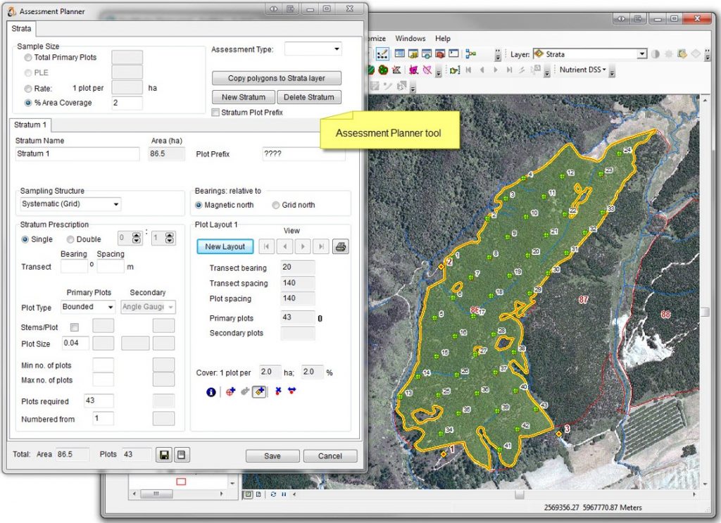
Use the Assessment planner to Plot, Transect, and Strata features that are stored in an ArcGIS geodatabase, and plot location maps can be generated at any time once the layout has been created.
The Assessment Planner is used for getting plots generated by this module that can be loaded into ATLAS FieldMan for collecting data for ATLAS Cruiser or ATLAS SilviQC. Plot information can also be exported in many other formats, including Shapefiles, CSV files, and GPX for GPS.
An assessment map can be created to assess an existing event in GeoMaster (e.g., for quality control) or can be created as an independent event (e.g., pre-harvest inventory). Every assessment is given a JobNumber, which enables it to be saved as a planned assessment in GeoMaster.
*Assessment Planner requires GeoMaster to be installed.
Features
- Supports multiple strata/assessments
- Supports single and double sampling
- Plots can be arranged in a systematic grid from a random starting point
- Plots can be randomly located, with/without replacement
- Plots can be distributed via a space-filling algorithm (“Quasi-random”)
- Supports transect sampling (Timberline) – as an alternative to plot sampling
- Bearings can be displayed relative to True north or Magnetic north
- Multiple layouts can be generated to choose from
- Plots can be added, moved, and removed within a layout
- Edge plots can be identified
- Reference markers can be created at known locations to aid the navigation of plots
- Strata polygons for an assessment can be widely dispersed throughout an estate
- Assessment configurations for various purposes (e.g., QC, Survival Survey, MRI) can be saved for re-use
The Module
Supports stratified random sampling by generating plot locations within one or more selected stratum polygons. These polygons can be created from GPS points and can be copied from another layer, e.g., patch/stand polygons or harvest area polygons, or through manual digitising.
In Addition to creating assessments, this module also enables:
- Plots to be added or removed after the assessment has been saved
- Maps to be re-created after the assessment has been saved
- Selected assessments to be deleted
- Multiple selected assessments to be exported in a single job