GeoMapper
Map Production Software
Atlas GeoMapper enables staff with minimal GIS training to easily produce clear, up-to-date forest maps for operational and reporting purposes.
Maps will automatically comply with business standards for map styles and symbology so that all maps have a consistent look. ATLAS GeoMapper supports a wide range of map types (e.g., Inventory, Harvesting, Compartment), each with its own specific layout.
| Benefits | Features |
|---|---|
| Rapid production of maps and using approved mapping standards | Map styles and symbology are all preset to business standards. All maps will display key information such as author, date, logo, etc (according to business policy). |
| Easy map production | Minimal GIS skills are required to produce maps since the appropriate layout and layers are automatically loaded. |
| Up-to-date maps produced as and when required | Map designs are based on templates stored in a database. Maps can be created when required, and users do not need to save maps for re-use later on. |
| Easily interpreted maps | Standard symbology and legends can be easily understood. |
| Values displayed from GeoMaster will be automatically updated | If ATLAS GeoMaster is used, fields describing compartments, stands, and operations will be updated each time a map is generated. |
| Map outputs to meet specific requirements | Maps can be printed or exported to a file (PDF, JPEG, TIFF). Paper size can be automatically selected depending on map scale and size, or paper size can be set depending on particular printing requirements. |
| Flexibility in map preparation | Standard ArcMap Tools can be used to alter maps before printing. |
| Batch printing of maps | Choose map type, select focus items (e.g., stands, compartments, map grids), select a printer or file output, and set the process. |
Users just select an area or event and directly produce a map that can be sent to a printer, exported to a file (e.g., PDF), or saved as an ArcMap Document
GeoMapper can automatically select the most appropriate size and orientation of paper based on the default scale and size and shape of what is being mapped.
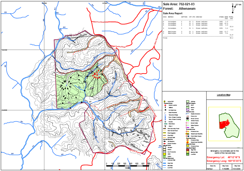
Integration with GeoMaster ensures that details of compartments, stands, and operations are up-to-date each time a map is generated. GeoMapper can be used to create a one-off map or run in batch mode to create a series of maps.
GeoMapper provides administrator-level tools for designing and managing map templates and implementing standard corporate-wide symbology. All map type definitions, templates, and layer references are stored and managed in a central database, so there is no requirement to maintain template files.